All posts by PLANETucker

Which Half of the Earth?

half-earth-cover

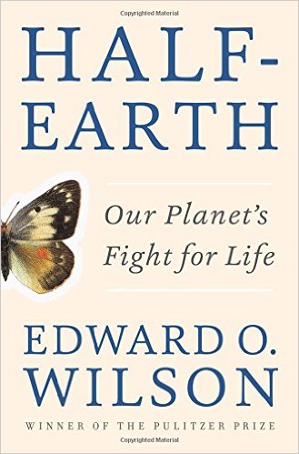
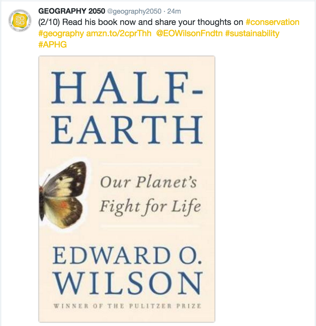
How much of the Earth should be protected from the plunder and hapless trampling of humanity? This is the central question animating E.O. Wilson’s new book Half-Earth: Our Planet’s Fight for Life. As the father of the term “biodiversity” and an early thought leader in the world sustainability, Wilson has long provided society a vast reservoir of concepts and insights that any person thinking about, or working on, sustainability should master. This is why we must all take his most recent thesis seriously.

Wilson’s biodiversity lens leads him to focus our attention on the major species collapse that has been underway, and accelerating, over the past couple/few centuries, as humanity has experienced exponential growth, explosive industrialization, and processes of urbanization and suburbanization, all of which have impinged, geographically, on critical ecosystems and the species they support.

population

In Half-Earth, Wilson shines a bright light on the need to protect entire ecosystems, as geographically contiguous spaces, since the complex relationships between all of the species within an ecosystem cannot be thought of as severable. In his estimation, if we are to prevent the impending complete planetary species collapse, which would have cataclysmic implications for carrying capacity of the Earth as humanity’s ecosystem, at least half of the Earth’s surface needs to be protected from the human footprint.
Through the course of his book, Wilson talks about some specific places that he believes should be protected from humanity, but mostly refers to existing protected areas, which of course each have concrete geographical representations, which can be viewed and analyzed in a Geographic Information System (GIS). However, beyond these protected areas, Wilson largely does not tell us what other geographies must be protected in order to get us to half of the Earth’s 509.97 million km2 (let’s just round down to 250 million km2).

“Today every sovereign nation in the world has a protected-area system of some kind. All together the reserves number about a hundred sixty-one thousand on land and and sixty-five hundred over marine waters. According to the World Database on Protected Areas, a joint project of the United Nations Environmental Program and the International Union for Conservation of Nature, they occupied by 2015 a little less than 15 percent of Earth’s land area and 2.8 percent of Earth’s ocean area. The coverage is increasing gradually. This trend is encouraging. To have reached the existing level is a tribute to those who have led and participated in the global conservation effort. But is the level enough to not just slow but halt the acceleration of species extinction? Unfortunately, it is in fact nowhere close to enough. Might the upward trend conservation efforts have set be enough during the rest of the century to save most of Earth’s biodiversity? That is problematic, but I doubt that it can be, and even then there will be far less biodiversity to save.”

Well, there you have it. When you place the bounding geometries of all existing protected areas on a map, you are left far from the goal needed for wholesale species collapse over the coming century – at least in Wilson’s assessment. So, what other geographies comprise the remaining 35% of the Earth’s land area, and 47.2% of the Earth’s ocean area if we are to reach Wilson’s goal?

This is one of the central questions behind this year’s Fall Symposium of the American Geographical Society, entitled Geography2050: Envisioning a Sustainable Planet. Thinkers and Doers from industry, government, academe and the social sector will provide their insights as to the geographies over which various conservation, restoration and other sustainability strategies will need to be deployed if we are to meet our collective societal goals by 2050. They are all encouraged to propose their own concrete geographies that relate to their specialty, whether it be forests, oceans, the Arctic, iconic species, sustainable cities, or what have you.

But, this is a thought exercise that everyone can become a part of. For those of you on Twitter, check out the invitation to participate at https://twitter.com/geography2050.

screen-shot-2016-10-03-at-12-54-11-pm

screen-shot-2016-10-03-at-12-54-52-pm

screen-shot-2016-10-03-at-12-55-18-pm

screen-shot-2016-10-03-at-12-55-28-pm

screen-shot-2016-10-03-at-12-55-37-pm

screen-shot-2016-10-03-at-12-55-50-pm

screen-shot-2016-10-03-at-12-56-08-pm

screen-shot-2016-10-03-at-12-56-23-pm

screen-shot-2016-10-03-at-12-56-32-pm

screen-shot-2016-10-03-at-12-56-42-pm

Who knows whether it is Donald Trump or Hillary Clinton who will become our next President of the United States. Rest assured, however, that the American Geographical Society will share the results of their “expedition to the future” with the future President, informed by the geographies that all of us believe need to be protected – far beyond the protected areas that are formally institutionalized today. So, Tweet your thoughts to @geography2050 today or email them to [email protected], and perhaps you can help shape a sustainable future for our planet.

But, just in case you are just too trapped within your human-centric mindset, and are having a hard time thinking about a world less trammeled by humanity, just remember some of E.O. Wilson’s concluding words:

“Wildlands are our birthplace. Our civilizations were built from then. Our food and most of our dwellings and vehicles were derived from them. Our gods lived in their midst. Nature in the wildlands is the birthright of everyone on Earth. The millions of species that we have allowed to survive there, but continue to threaten, are our phylogenic kin…History without the wildlands is no history at all.”

And there you have it.


Move over Internet of Things – Here comes Space Time Robotics

robot-earth.hallmarkThe Internet of Things (IOT) is a hot topic these days.  All the cool kids are doing it.  Every company is adopting it as their battle flag.  While “The Internet of Things” (IoT) as an idea has been around since 1999, it has only come into its own in the past few years.  And, in 2014, it seems that nearly every tech writer was compelled to fan the flames of interest in the subject.  Going back to its beginning, I always liked the idea of IoT, but also found it vaguely unsatisfying.  Maybe its because I was never an EE guy focused on the physical networking layer.  I guess I always assumed the Internet’s existence, and focused on the Web layer.  After all, I left my small town for the big city in order to go to college just as the World Wide Web was emerging.  So, for me, it was all Web all the time.

At virtually the same time that IoT was coined, I met Dr. Mike Botts at a Technical Committee meeting of the Open Geospatial Consortium (www.opengeospatial.org) in Atlanta.  It was the first TC for both of us.  I was a new sponsor of the OGC, in my role as Chief Strategic Officer of In-Q-Tel, the CIA’s venture fund.  He was a principal research scientist at the University of Alabama at Huntsville, having done a stint at NASA headquarters, trying to figure out a strategy and implementation that might help achieve interoperability amongst their many sensors.  Space based sensors, predominantly.  But, Mike came in to the OGC process with a rich vision for sensor interoperability in which his “SensorML” could be used as an abstraction layer that would enable an architecture for constructing massively distributed, heterogenous SensorWebs comprised of space based, airborne, mobile, in situ and terrestrial remote sensors.  Not a network (e.g., Internet).  But a web (e.g., WWW).  Sensor Web Enablement (SWE) is the term that emerged within the OGC process.  SensorWeb was the shorthand.  And, within the OGC, all SensorWebs were rigorously geospatially-enabled and location aware.  As such, the whole time everyone was talking more and more about the Internet of Things, all I could think about the Location Enabled Web of Things.  Too bad “LEWoT” was a horrible acronym.  Otherwise, given the tech world’s fetish for snappy acronyms, regardless of the irrelevance of the content backing them up, we could have been off to the races within something well beyond what that IoT had to offer.  But, alas…

Interestingly, the OGC SWE architecture continued to evolve at a healthy pace, and it became widely adopted, on a global scale.  I like to say that it succeeded at becoming a globally adopted architecture, but not ubiquitous.  By 2009 or so, people were using SWE to task remote sensing satellites, task UAVs and their sensors, publish ocean buoy networks, enable webcams as location aware services, demonstrate terrestrial remote sensors such as doppler radars, and publish a variety of mobile and in situ sensors as interoperable OGC services.  The EU even developed a program called “Sensors Anywhere” (or SANY)  from which a book was authored.  As a member of the Board of Directors of the Open Geospatial Consortium, this evolution was a point of pride.  OGC had midwifed a global architecture that could deal with the most simple to the most exotic sensors on the planet, as well as near space.

Somewhere over this evolution, things got curiouser and curiouser.  I remember asking Mike “So, SWE isn’t just dealing with sensors?”, observing that applications of this architecture were doing things like tasking the movement of platforms like UAVs.  It was then that Mike blew my mind.  “Well, SensorML and SWE support sensors, actuators and processes.”  To a non-engineer, this is the kind of succinct statement that I remember my best professors leaving me to chew on for years.  Over many beers and many conversations (yes, I am slow), I came to ask things like “so, could you interface with a constellation of semi-autonomous robots using SWE?”  To which Mike would say things like, “Well, they are simply combinations of sensors, actuators and processes.  So, yes!”.  A constellation of geographically-enabled, location aware, semi-autonomous robots orchestrated and managed by SensorML and SWE.  Now that would be crazy.

This was the moment when I became unsatisfied not only with the term IoT, but also with Sensor Web Enablement, or SensorWebs.  They are perfectly good terms, so don’t get me wrong.  In particularly, I would definitely self-identify as a “sensor freak”.  And, I am super thrilled with the latest evolution of Mike’s OGC SWE vision, with the launch of his team’s license free open source software platform for geospatial (FOSS4G) sensors, called OpenSensorHub (www.opensensorhub.org).  But, both these terms fail to grasp what I consider to be the key elements of the emerging future.  What platforms like OpenSensorHub will enable is what I have taken to calling “Space Time Robotics”.  After all, what do you get when you integrate sensors, actuators and processes?  Robots.  Thats what.  And, not just anthropomorphic robots like Twiki from Buck Rogers or “Robot”(full name, B-9, Class M-3 General Utility Non-Theorizing Environmental Control Robot) from Lost in Space (did I just date myself?).  Robots will manifest in a variety of forms, including massively distributed networks of sensors, actuators and processes that shape how we experience the landscape in which we live.  And, when they are geographically-enabled and location aware…or more specifically, spatio-temporally aware…what will happen?  Their existence, observations, assessments and actions will span time and space.  The same time and space in which we as human will exist.  So, sure.  The Internet of Things is great.  But, the era of Space Time Robotics will arrive sooner than we imagine, and the term IoT will feel insufficiently descriptive when it does.

Rethinking Ourselves and the “Other” Through Genographics

Screen Shot 2014-12-17 at 5.55.21 PM

Last year, my brother got me a Geno 2.0 kit from National Geographic.  It took me a while to get around to it.  But, now that I have done it…  Coolest. Gift. Ever.  Particularly if you are a sucker for genetic anthropology, and a map freak to boot.  I mean, its one thing to spend tons of time hunting down different animated maps depicting mankind’s diaspora from Africa (like the National Geographic’s Global Human Journey; or Professor Stephen Oppenheimer’s “Journey of Mankind: The Peopling of the World” funded by the Bradshaw Foundation; or this not-so-animated Genetic Atlas of Human Admixture History; or this completely static World map of Y-chromosome haplogroups – really, why is this not animated!)  Its an entirely different thing to have your own mitochondrial DNA sequenced and plotted over time against these geographic haplogroup mappings.  See mine here.

Its fascinating.  I have long thought the concept of race was crap.  Growing up as a racist (oh, and sexist and homophobic) white southern male in the 1970s and 80s, it took me a while to get to that point in life.  But, getting the results of the Geno 2.0 kit made it very clear.  In my youth, my Scotch/Irish/British/WASP and pioneer-stock roots clearly imparted me special “caucasian” status, along the traditional racial lines of distinction that were culturally reinforced every day in “The South”.  Even as a fan of Charles Darwin and the Origin of Species, my youthful ignorance could not be eroded.  It wasn’t until the concepts of “genetic anthropology” and mitochondrial DNA were popularized that my small brain finally grasped that the variety of humanity (both genotypically and phenotypically) was more like different breeds of canines (though, even less material) than the tired concept of “race”.  And, that over the past 100,000 years, mankind had journeyed from its point of origin in eastern Africa to every corner of the Earth, adapting genetically and in physical appearance from time to time.  But, no.  These changes have manifested more as illusions obscuring the truth than anything truly meaningful.  Thanks, evolution.  Really helpful.

My maternal and paternal DNA map from the Geno 2.0 kit was eye opening.  As best as I can tell, Mom is kind of a Fertile Crescent girl, with a lot of her ancestor’s time spent in Western Asia, kind of at the intersection of Iran, Western Turkey, the Caucuses and the like, going back as far as 55,000 years.  Dad is more of an Egyptian. His ancestors stayed in Africa, mostly around current day Ethiopia, Sudan and Egypt until say 18,000 years ago, until his ancestors jumped the Mediterranean into the present day eastern Turkey and the Balkans.  (What is funny about this to me is that as a kid growing up in Central Florida, when the Mormons or Jehovah’s Witnesses would come by the house asking whether he had ever read the Bible, he would turn on his thick British colonial Trinadadian accent and say “I’m Muslim”, which would send them moving along pretty quickly.)

Interestingly, the major haplogroups that define their distant past (both mom and dad), going back 60,000 years are majorly different – even though in a modern context they would both be considered standard “white people”.  But, also, there are no specific haplogroups that define either my father’s “Britishness” or my mother’s “American frontiersman” heritage.  Discernible genetic differences end about 10,100 ± 1,610 years ago for Mom and 10,000 – 20,000 years ago for dad.  I have long understood that the Brits are basically “mutts”, with crazy mixes of waves of Paleolithic, Celting, Angle-Saxon and Norsmen/Norman genes intermingled in interesting ways.  But, still, I would have thought that somehow these would have been identified in distinct haplogroups.  Alas, no.  I guess this is the difference between genotypes and phenotypes?  Or, as I have long said, race actually isn’t a thing.  Groups of humans have long used all sorts of criteria to exclude others, and have reinforced their unique differences through costly measures that demand demonstrable commitment, and they have long used the term “race” as a shorthand for these differences.  We have long distinguished ourselves against the “other” using the term “race” as code for the cultural differences that we preternaturally reinforce (and otherwise guard against) with various social control mechanisms.  In particular, the cultural differences include language (including dialects, vocabularies, and even accents), clothing/dress, hygiene, scent/odor, religious/moral commitments, diet, dietary induced physical/physique development, cohabitation standards, familial expectations, obscure ritual interactions, and all of the social differences that we find “weird” and “foreign” in the “other”.

So, when I get that US Census form that asks me to check my race, I am definitely going to start checking “other”.  I know that these Census data help social scientists make broad group based assumptions about our behavior.  But since that in turn is too often used to devise social control mechanisms to influence the behavior of “African Americans”, “Latinos” and so forth (which has turned out oh so well, right?!?!), perhaps everyone opting out of this problematic measurand would force more sophisticated thinking about the commonalities that could lead to cultural solidarity, and the actual differences that must be analytically understood in order to form a more Perfect Union.

As for Geno 2.0, all I can say is that this is super cool.  Do it.  Seriously.  Just do it.  And, buy it for your friends and family.  Its a great gift.  Happy Holidays.

Geography 2050 – finally, a strategic dialog based on geography

2050 LogoIn the Fall, I was elected to the Council of the American Geographical Society, which is a cool organization with a very long history.  It was founded in 1851 as the first scholarly organization in America dedicated to the study of geography.  And, as you might expect from the era, they were heavily involved in mounting expeditions to the Poles, to the American West, and to exotic countries of which we (Americans) knew little.  Expedition was a primary mode of geographical research.

Well, the world has changed.  In the 20th century, we saw the rise of satellite remote sensing and the establishment of a global positioning system that enabled precision geopositioning by surveyors, and at the beginning of the 21st century, anyone with a cell phone.  Also, over this 160 years, the actual geography of the world has changed.  While the continents have only moved centimeters, humans, human activity and the technologies we have unleashed have remade the geography of the world.  And, this process of change will only accelerate in the future.

It is with this view on the world that the AGS has come to revive the role of expeditions.  Yes, the AGS will continue to mount socalled “Bowman Expeditions” named after their former Director Isaiah Bowman, to work with local and indigenous populations to make sense of their world through participatory mapping.  But in addition, AGS will now be exploring our future world as it convenes its Fall Symposium entitled Geography 2050:  Mounting an Expedition to the Future.

Screen Shot 2014-09-04 at 1.51.49 AM

This effort is not just a single event.  The November 19th Symposium, hosted by Columbia University’s Earth Institute in the historic Low Library, will be the inaugural event of a multi-year strategic dialog about how our world will change between now and 2050, the major factors driving these trends, and the investments that we will need to make in order to better understand, anticipate, and weather this change.

The coolest thing is that this event is not just about sitting and listening  to smart people (though, feel free to come, sit and listen!).  Rather it is about engaging this process as a thinker yourself, and engaging Geography 2050 as a platform for participation.  Come and speak up with your ideas and analysis.  Perhaps you could take a lead in driving the debate and analysis about our changing world by participating in this inaugural event, and the many events that will flow from it.  Perhaps you can help society navigate this uncertain future more effectively.

See you in NYC on November 19th!  Register now!

A New Twist on Human Geography

USGIF Monograph

OK, so I know that I have gone radio silent for a long time, but I told myself that I would not spend energy blogging until I met my commitment to get this first monograph by the United States Geospatial Intelligence Foundation (www.usgif.org) published.  As a Board member of the Foundation, I was asked to help honcho this effort with my colleagues Dr. Robert Tomes and Dr. Darryl Murdock.  Lets just say that it took longer than anticipated, thus explaining the enormous gap in my blog posts.  We assembled a fantastic mix of folks for this edited volume including the Geographer of the United States, the US Army’s Geospatial Information Officer, super-badass geostrategist Parag Khanna, and a wide variety of fantastic scholars and practitioners of human geography.  A sincere thanks to all who contributed, and an apology for the ridiculously long time it took to get to press.

This was an interesting exercise, because it was looking at the way various socio-cultural dynamics impact global security, and the wide variety of disciplinary and professional lenses that are applied to these dynamics in the national security community.  Many competing terms had seen lots of investment and energy within the national security community during the 2000s including human terrain, cultural intelligence, social network analysis, and the like.  And, of course, good old human geography had its storied history in contributing to the national security enterprise.  In one volume, we could only cover so much, but this volume definitely provides a worthwhile view on the field and the complex issues it struggles with.

Anyways, no blog post can do it justice.  So, I encourage you simply to pick one up at Amazon here.


Planet Labs Makes Orbit

Flock1_PlanetLabs4X3

Wow, so the guys at Planet Labs just launched 33 cubesats from the International Space Station.  Not just the 2 in the picture. But 33.  I would love to see a picture of that!  But, moreover, I cannot wait to see the imagery from these birds.  Word is they are going to launch a bunch more, and provide the most frequent re-imaging of the Earth’s entire surface ever achieved.  And, on pure venture funding!  No government funding at all.

planet-labs

This is going to revolutionize how we think about change on Earth.  I am super pumped to get ahold of cool sequences of change to load into MapStory.org and to tell amazing stories that cant be understood without great and frequent remote sensing.

Congratulations Planet!  Keep tossing them up there!

p

MapStory – the beginning of a little experiment

MapStory Logo


This week at the Free and Open Source Software for Geospatial (FOSS4G) conference, here in Washington DC, my co-conspirators (thanks to many, including Robert Tomes, Ian Schneider, and Chris Holmes) and I launched the web presence for a little social venture of mine.  It is basic, and very rough – but at www.mapstory.org you can see the beginnings of something that I have had brewing for quite some time.

When the WWW first popped up in the early 1990s, I was at Columbia University as an undergrad, working in the Provost’s Office, under Michael M. Crow and Jonathan Cole, when the Mellon Foundation launched a website called JSTOR.org.  As an aspiring social scientist, this was a major event, as now I could word search, find, read online and print virtually every social science journal back to the 1880s.  No more fistfull of dimes at the xerox machine anymore.  The transformation of how social science knowledge was organized and shared was pretty amazing.

But, as a redneck who lacked the proper nouns to search and find what I wanted to know, I dreamt of a MAPSTOR.org that I could search spatially and temporally (you know, a bounding box and a time stamp) and find out what the preponderance of social scientists knew about what had been going on.  And, the site could convey this information in MapStories – yes, a cute play on words.

Alas, it as just a casual thought that floated around my brain for some time.  After all, I had a Masters and PhD to complete, a job to get, a beautiful bride to find and marry, children have and to raise, a home to create, etc.  Of course, the bigger barrier was simply that web mapping technology did not even exist at that time.  Nor did a business model for populating such a site.  However, as I forged ahead on the lifepath outlined above, technology advanced (particularly license free, open source geospatial technology – thanks OpenGeo!), and crowd-sourcing business models proved their worth though projects like Wikipedia.  So, when I had some flexibility in life in 2008, I decided to venture off and see what might be done to bring this dream to reality.  It took a while, but here we are.

If this thing goes right, MapStory will serve as a new dimension to the global data commons (yes, we call it MapStory because the JSTOR lawyers were none too pleased! – and its a better name anyways) that enables everyone on earth to organize and share what they know about their world spatially and temporally, instead of encyclopedically the way Wikipedia allows.  This data (what we call StoryLayers) will be shared with the world under a Creative Commons license, and perhaps someday we will have the technology to make them editable by the crowd the way a wiki works.  Also, (again, if things go right) MapStory will empower people to publish their narratives (what we call MapStories) atop this data to a global audience.  A global megaphone by which everyone can tell their stories about the world.

There are many technical and business model challenges ahead, but the OpenGeo technical community that has helped build MapStory.org using their open source geospatial software has gotten us off to a great start.  And people have already come out of the woodwork with their very cool ideas about the kinds of StoryLayers and MapStories that should be available to the world.

Cross your fingers.  Or even better, get involved!  MapStory is an open platform for participation that anyone can shape and improve over time.


Omnivorous Feathered Apes in New Caledonia

New Caledonia

Only three species of animals on Earth make tools: elephants, chimpanzees (as Jared Diamond would say, humans are the Third Chimpanzee), and New Caledonian crows.  Meta-tool use is considered crucial in the evolution of humans.  And, yes.  New Caledonian crows are there.  The crow’s brain size as compared to their body size is comparable to many primates.  As such it is appropriate to think of them as feathered apes.  And, then there is their social structure, which is more like human social structure than that of any other primate – enabling a leap forward in evolutionary cognitive development. 

You have to watch this:  A Murder of Crows, NOVA (sorry, this is just a preview). 

It won’t just be cockroaches left after humanity self-immolates.  I would bet crows will survive.  And, give it several million more years of evolution, and the crows will fill our niche.

Teach Washington DC About Napoleonic Know-How

Young-Napoleon-on-Horse-by-David

So, I recently met a gentleman by the name of Doug Batson who coined the term “Napoleonic Know-how” to describe the administrative functions associated with the Napoleonic Code – specifically, the management of land parcels – what the experts call the “cadastre”.  Doug is an expert in toponyms.  In particular, he is an expert in toponyms from Turkic tongues.  But, he is also an expert in cadastral data, land tenure issues, and the establishment of systems for the management of land parcel data.

What I love about the term Napoleonic Know-how is that it shines a light on the administrative capabilities that underpin democracy and capitalism, but which none of the Washington Commentariat or policymakers are even conscious of.  They scream for the US to establish democracy and capitalism around the world, but they wouldn’t be able to recognize the administrative functions required to underpin their success.   No, Napoleon was not a democrat or a capitalist. Napoleon used the cadastre to establish an iron grip on the European continent through his Napoleonic Code and the land management system it engendered.  And he built upon this system unique addresses (for the parcels) which helped locate each person to a specific plot of land on their identification card.  It was an mechanism of oppression and order.

But, systems built during one time for a specific purpose often take on different social purposes over time.  And, the way it was manifested in English Common Law, and under George Washington and the Founding Fathers had a different effect.  For some reason, policymakers in the US have completely forgotten that capitalism only exists because of legally codified property rights.  And, law enforcement and contracts are only workable when each individual is uniquely identified and tied to residences and places of employment via addresses.  And, representative democracy only works when it is periodically reapportioned based on the results of the census.

What I love about it in particular is that Napoleon, widely considered to be one of history’s greatest battle commanders saw his greatest accomplishment as his creation of the Napoleonic code.  But, yet, our national security community do not understand the role of such administrative mechanisms in establishing stability and underpinning open society.  Instead, are organized to kill our way to stability.  Maybe our battle commanders could learn from Napoleon, and work to establish a well managed cadastre, address systems, unique IDs, and a systematic census in the conflict zones to which we so readily send out troops.  Perhaps if we underwrote this investment in countries of national security concern to us, we could help enable the development of open administrative capacities that make stability more feasible.

Frak Natural Gas! Watch GasLand

shale_playmap

(Geo)graphic provided by the Google Machine.

Never let it be said that I don’t admit when I am wrong.  Just over a year ago, I posted a glowing recommendation for a book (which had been showcased by the Aspen Strategy Group (which I generally hold in high regard)) that touted the virtues of natural gas as “the gas bridge” to a renewable energy future.  The enormous volumes of deep natural gas that the book, The Great Energy Transition, described seemed like such a clean burning alternative to oil and gasoline (particularly after my trips to New Delhi where Compressed Natural Gas – CNG – was clearly creating a better, cleaner Delhi).  But nowhere in that book did the author, Robert A. Hefner, III, discuss the Fraking Process.

No, this is not something from my wife’s favorite TV show, Battlestar Galactica.  It is the “fracturing” process that Halliburton got exempted from the Clean Water Act, Clean Air Act, and many other laws and regulations in order to crack the underground geology where epic amounts of natural gas resides.  It is this fracturing that is required to free the gas.  As it turns out, the extremely toxic chemicals used in this Fraking process, and the natural gas itself is contaminating the ground water in 34 states.  And, by contaminating, I mean, for instance, people’s drinking water can be LIT ON FIRE!!!

I had no idea, until I watched the documentary GasLand on HBO.  Yes, Dick Cheney is complicit.  But, he is just a sideshow.  Watch this documentary and you will abandon the natural gas bridge to a brighter future.  This is just another case of a rosy picture being sold of an energy source, without a net assessment of the total lifecycle environmental impact.

Can anyone tell me why the mainstream media is completely incapable of discovering things like this?  Did it really have to be left to some guy living in Pennsylvania with his CamCorder?

I now feel bad for my children, and somewhat helpless to fix this.  As I live here in Washington, I observe the complete and utter silence, even with Democrats controlling both chambers of Legislative Branch, and the White House.

I think I will have another glass of wine.