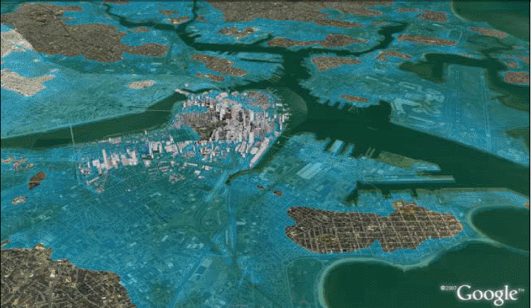
Geo(graphic) of Boston under a 5 meter sea level rise provided by Architecture 2030.
I recently asked my friends at CIESIN for a 1 and 2 meter sea level rise run on a high resolution digital elevation model so I could peruse my Florida ocean front real estate options. Given the economic conditions down there, I’m looking to buy. Scientific consensus has us about 1.5 meters down by 2100. If I’m going to spend my hard earned money on beach front property, I want ensure that my great grandchildren are not under water. I’ll get the data from CIESIN once the holidays are complete and post some prime ocean front real estate spots for the 2100-2200 AD/CE time frame, but in the meantime, I found a nice little report with some nice pics that validate my Florida concerns.
Unfortunately, the Florida pics aren’t as good as this Boston shot (above). They didn’t include a 1.5 meter pic of Boston that was big enough for my blog. I would have used that. Instead, they went for the dramatic 5 meter model with the simple heading, “During the last interglacial period, 125,000 years ago, when the earth was this warm (2 °C to 3 °C warmer), sea level was four to six meters higher than today.” Somehow, I don’t think (though I haven’t checked) that it is supposed to take 125,000 years to get back to this level.